|
Task 1: Draw from memory, a map of Canada and label the provinces and territories. Include where the U.S.A borders Canada, and if possible, any significant bodies of water. When you are done, compare with someone in the class. Then, compare with an actual map of Canada. How accurate were you? Think about... ...the types of previous knowledge you had that helped you draw your map. ...the areas on your map that were inaccurate (way off!) Why were these parts hard to remember? Task 2: Now, take a look at the following maps of Canada and compare to the recent map shown below. These maps date from 1662 to almost 1999. Use your previous knowledge of how to read maps to identify how the land that is NOW Canada, used to be divided and 'owned'. Be sure to find the "legend" in each map too! On the link below, you need to go to the left hand side bar of the website and click on "EARLY MAPS" to get to the historical maps. Once on the page with the maps dated from 1600's to 1800's, you will see another link to more historical maps that will take you from 1860's to 1999. 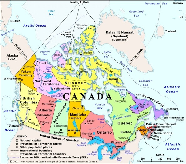 What do these maps tell you about Canada's story and how the country came to be?
Record in your duo tang on lined paper, 3 things about the maps that you find interesting. Record at least 2 questions you now have about Canada's story from looking at these maps. |
AuthortWrite something about yourself. No need to be fancy, just an overview. Archives
January 2015
Categories |
 RSS Feed
Proudly powered by Weebly